Links:
Calero County Park
Calero Park Map
Santa Clara County Parks
Park Activities Calendar
Healthy Trails Hikes:
Healthy Trails Program
Santa Teresa, 5/4/08
Uvas Canyon 2/21/09
Almaden Quicksilver, 3/28/09
Nearby Parks:
Santa Teresa Park
Friends of Santa Teresa Park
Almaden Quicksilver County Park
New Almaden Quicksilver County Park Association
Rancho Canada Del Oro Open Space Preserve
Guadalupe River Park and Gardens:
Guadalupe River Trail
Guadalupe Creek Trail
Ron Horii's Park and Trail Pages:
Los Alamitos Creek Trail
Coyote Creek Trail
Bay Area Biking
Bay Trails, South Bay
Bay Area Parks
Santa Teresa Park
Almaden Quicksilver Park
Bay Area Back Pages
SF Bay Rec & Travel
Healthy Trails Hike, Calero County Park, 4/25/09
On
April 25, 2009, a Healthy
Trails hike was held at Calero
County Park.
It was led by docents Cait Hutnik and Woody Collins. It started at the
parking lot near the Calero Ranch
Stables, next to McKean Road, south of Bailey Avenue. Calero Park
covers 3493 acres. It includes Calero Reservoir, a popular lake for
boating and fishing. The backcountry hills of the park have 18.6 miles
of trails open to hikers and equestrians (no bikes or dogs on the
trails). There are two Healthy Trails hikes in Calero. A 2.8-mile
moderate hike follows the Figueroa, Vallecito, Pena, and Los Cerritos
Trails. A 6.2-mile strenuous hike follows the Figueroa, Javelina, Pena,
and Los Cerritos Trails. Cait led the group on the shorter hike,
while Woody led a group on the longer route.

Cait Hutnik talks to the crowd gathered for the hike.

Waling to the trailhead to pick up maps.

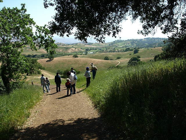
Walking along the access trail, with Woody at the lead.

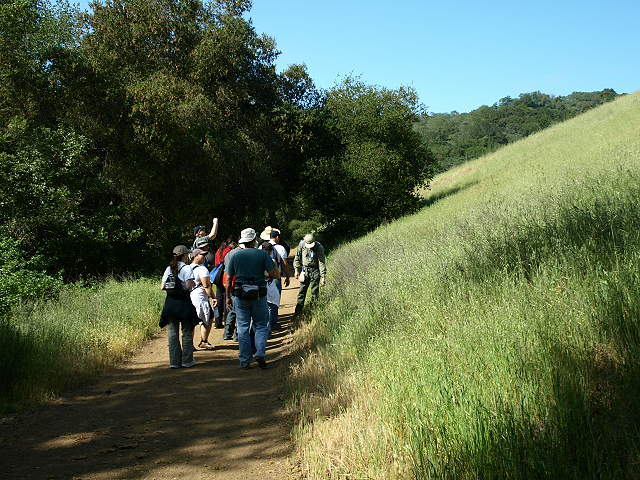
Heading up the access trail.

Cait coming up the trails with the families.

At the trail junction, heading up the Figueroa Trail.

Cait and her group approaching the trail junction.

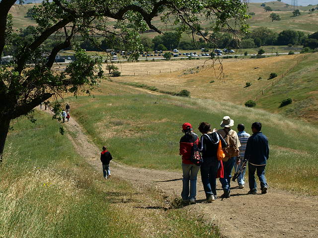
Heading down the Figueroa Trail next to McKean Road.


Ahead, the trail pulls away from McKean Road as it follows Calero Creek upstream.


Mule's ear sunflower.
Woody points to some weeds along the trail.
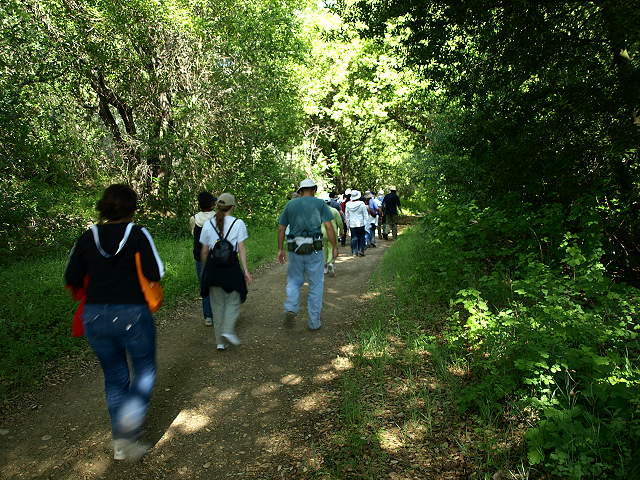
The trail heads into a shady section along Calero Creek.

Calero Creek.
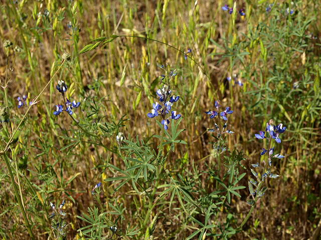
Bicolor lupine, also called miniature lupine, line the trail.

At
the Canada Del Oro Trail junction. The Canada Del Oro Trail is a
relatively new trail that leads to the southwest section of the park
and the Rancho
Canada Del Oro Open Space Preserve.

After crossing Calero Creek, the trail heads uphill to the Vallecito Trail junction.

Cait's group coming out of the forest and crossing Calero Creek.

At
the Vallecito Trail junction, Woody led part of the group farther up
the hill on the Figueroa Trail for a longer hike to the start of the
Pena Trail, while Cait took the
rest of the group back on the Vallecito Trail.

Cait's group heading back on the Vallecito Trail.

Cait talking about the trees.

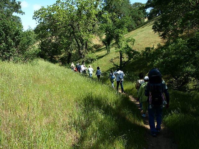

The trail ascends the side of the valley to reach the Pena Trail.

Looking back at the Vallecito Trail.

On the Pena Trail, heading downhill.
Cait stopping to take a group picture on the Pena Trail.
Heading downhill on the Pena Trail to the Los Cerritos Trail, with the parking area in the background.
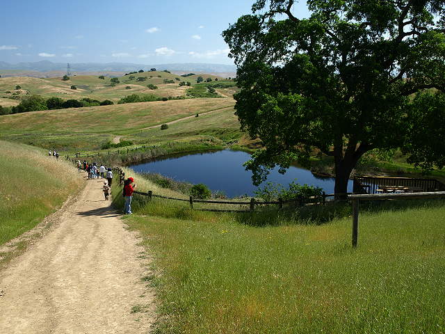
The Los Cerritos Trail leading to Los Cerritos Pond.

A family of geese on Los Cerritos Pond.

Los Cerritos Pond.

At the Los Cerritos-Figueroa Trail junction.

Cait with her group come down the access trail to the trailhead.
Pictures From Cait Hutnik, taken in Calero:

Group picture on the Pena Trail.

Grass skipper.

Gopher Snake
Pictures From Woody Collins, taken in Calero:
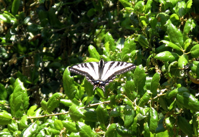
Pale swallowtail butterfly

Anise swallowtail butterfly
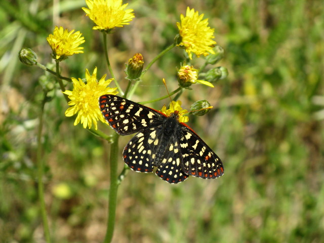
Variable checkerspot butterfly

Iris
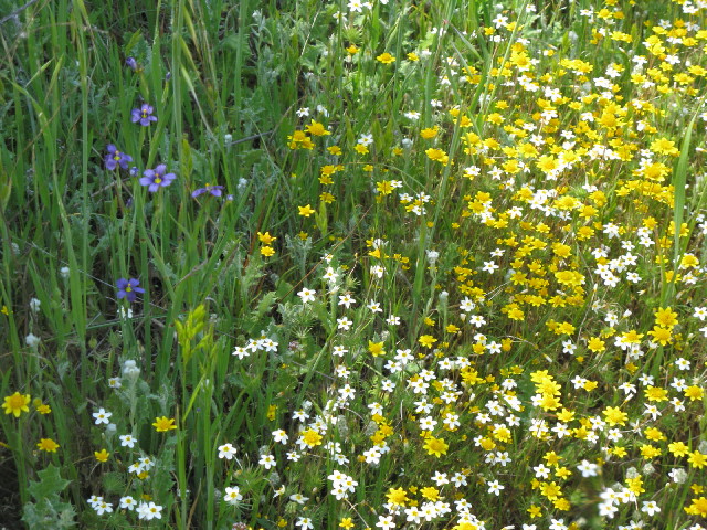
Blue-eyed grass, goldfields, linanthus.